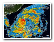
Potentially catastrophic Super Typhoon Megi(Juan) approaching the Philippines

Typhoon MEGI (Juan), 18.October 2010

Super-Taifun "Megi" (Juan): Böen bis zu 350 km/h
18. Oktober 2010, 06:30

Monday, Oct.18.2010

The official international name of the storm is Megi, which means “catfish” in Korean. But the storm is known locally in the Philippines as “Juan”, as the Philippine Atmospheric, Geophysical and Astronomical Services Administration has its own naming system.

The world's strongest tropical cyclone of 2010 is Super Typhoon Megi, which hits the the PHILIPPINES and intensified into an extremely dangerous Category 5 super typhoon with 180 mph winds this morning. There is a hurricane hunter aircraft in Megi, as part of the Interaction of Typhoon and Ocean Project (ITOP), which is studying how the ocean responds to typhoon growth and movement in the Western Pacific Ocean. As part of ITOP, a C-130 hurricane hunter aircraft was in Megi this morning, and measured some truly remarkable winds and pressures. At 8:09am EDT (12:09 UTC), the aircraft measured winds at flight level (8,000 feet) of 220 mph. The SFMR surface wind measurement instrument recorded surface winds of 186 mph in regions where heavy rain was not contaminating the measurement, but found surface winds of 199 mph in one region of heavy rain. Now, this measurement is considered contaminated by rain, but at very high wind speeds, the contamination effect is less important than at lower hurricane wind speeds, and it is possible than Megi's surface winds are close to a sustained 200 mph. This is supported by the flight level winds of 220 mph, which support surface winds of 199 mph, using the usual 10% reduction rule of thumb. The Hurricane Hunters measured a surface pressure of 893 mb at 12 UTC. This is a phenomenally low pressure, ranking Megi as the 20th strongest typhoon ever recorded in the Western Pacific. Only three Atlantic hurricane have been more intense than Megi--Wilma (2005) at 882 mb, Gilbert (1988) at 888 mb, and the 1935 Labor Day Hurricane, at 892 mb. Megi's intensity easily beats out 2010's other two Category 5 storms, March's Tropical Cyclone Ului in the South Pacific and the East Pacific's Hurricane Celia of June, which both peaked at 160 mph winds. It is still possible that Megi will intensify further, as wind shear is low, less than 10 knots, SSTs are very warm, and the ocean has a very high total heat content.

Megi is poised to deal a devastating blow to the northern portion of the Philippines' Luzon Island early Monday morning. If the super typhoon's winds stay near 180 mph, the damage will be catastrophic in the regions where the eyewall makes landfall. The Philippines government is taking Megi very seriously, and has ordered evacuation of all low-lying regions in Megi's path. Equally dangerous will be Megi's torrential rains, which will likely be more than 12 inches over wide regions of northern Luzon, creating dangerous mudslides and life-threatening flash floods. Once Megi crosses Luzon, the storm is expected to re-intensify and hit the Chinese coast between Hainan Island and Hong Kong as a major typhoon on Friday. Storm chaser James Reynolds is in northeast Luzon, and will be shooting pictures and video that he will upload his website typhoonfury.com, and Twitter, @TyphoonFury.

The popular tourist and diving spot MALAPASCUA Island, north of CEBU in the Visayan Sea, will not  be affected, but also strong winds from the west coast are present.

More info see under : http://www.wunderground.com/tropical/tracking/wp201015_sat.ht ml#a_topad

Tropical Storm Tracking Map:
http://www.wunderground.com/tropical/tracking/wp201015_flasht ool.html?extraprod=flashtool#a_topad


Der offizielle internationale Name des Sturms ist Megi, das bedeutet "Wels" auf Koreanisch. Aber der Sturm ist vor Ort in den Philippinen als "Juan" benannt, weil die Verwaltung der “Philippine Atmospheric, Geophysical and Astronomical Services” ihre eigene Namensgebung für Taifune hat.

Sturm hat Kategorie 5 und ist der stärkste seit langem

Der stärkste Taifun seit Jahren rast auf die philippinische Insel Luzon zu. Mehr als 3.000 Menschen wurden nach Behördenangaben aus küstennahen Gemeinden in Sicherheit gebracht. Ein Mensch ertrank, als er von einem Fluss mitgerissen wurde. Über dem Nordteil der Insel gingen bereits heftige Regenfälle nieder. Es tobte ein starker Wind. Die Behörden rechnen damit, dass riesige Wellen auf die Nordküste prallen werden.

"Megi" ist der zehnte Taifun auf den Philippinen in diesem Jahr und werde später am Montag in der Provinz Isabela das Festland erreichen, wie die Plattform Tropical Storm Risk berichtet. Er wird als Kategorie 5 eingestuft, die höchste Stufe in der Skala, und gilt damit als Super-Taifun.

Der Sturm könne sich gar auf Spitzenwindgeschwindigkeiten von bis zu 350 Stundenkilometer steigern, wurde im US-Fernsehsender CNN unter Berufung auf ein Taifunwarnzentrum erklärt. "Megi" ist für die sturmerprobten Philippinen der stärkste Taifun seit langem.

Flüge gestrichen, auch Manila bedroht

Mehrere Inlandsflüge wurden annulliert. In den Bergen kam es bereits zu Erdrutschen. Der Chef der Wetterbüros Graciano Yumol warnte auch die Bewohner der weiter im Süden liegenden Hauptstadt Manila vor heftigem Regen.

Präsident Benigno Aquino versetzte alle Regierungsagenturen in höchste Alarmbereitschaft. Die Küstenwache wurde angewiesen, das Auslaufen von Fischerbooten zu verhindern. Tausende Soldaten und Freiwillige standen bereit, um auch mit dem Einsatz von Hubschraubern zu helfen. Zahlreiche Pakete mit Notverpflegung seien gepackt. Schulen in Einzugsbereich von "Megi" blieben geschlossen.(APA/Reuters)

Die bei Touristen und Tauchern beliebte Insel MALAPASCUA in der Visayan Sea, nördlich von Cebu ist davon nicht betroffen. Es herrschen miitlere Winde von Westen vor.


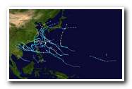
 Thypoon MEGI Satillite view                          MEGI 5 days forecast                  Thyphoon activities Eastern Pacific 2010

The state weather bureau downgraded storm warning signals further Tuesday morning as Typhoon “Juan” (international codename: Megi) continued to move away from the Philippines and towards the South China Sea.

In its 5 a.m. bulletin, the Philippine Atmospheric, Geophysical and Astronomical Services Administration (PAGASA) plotted Juan at 210 kilometers west southwest of Laoag City and moving northwest at 22 kilometers per hour with maximum winds of 160 kph near the center and gustiness of up to 195 kph.

The provinces of Ilocos Norte, Ilocos Sur, Abra, La Union, Pangasinan and Zambales are still under Signal No. 2 while a large portion of Luzon remained under Signal No. 1.

Signal No. 1 remains hoisted over Apayao, Cagayan, Kalinga, Mountain Province, Isabela, Ifugao, Benguet, Nueva Vizcaya, Quirino, Aurora, Tarlac, Nueva Ecija, Pampanga, Bulacan, Bataan, Cavite, Lubang Island, and Metro Manila.

PAGASA said occasional rains will be experienced in the western sections of Northern and Central Luzon as Juan continues to exit the country.

Classes in pre-school in the areas covered by Signal No. 1 are automatically suspended.

Das staatlichet Wetteramt hat die Sturmwarnsignale weiter herabgestuft  als Dienstag Morgen den 19.10.2020 der Taifun "Juan" (internationale Codename: Megi) weiter von den Philippinen weg in Richtung auf das Südchinesische Meer zog.

In ihrem Bulletin 05.00 Uhr, vorgetragen von der philippinischen “Atmospheric, Geophysical and Astronomical Services Administration” (PAGASA) bewegt sich Juan 210 Kilometer südwestlich von Laoag City Richtung Nordwesten bei einer Geschwindigkeit von 22 Kilometern pro Stunde und einer maximalen Windgeschwindigkeit von 160 km / h in der Mitte und Böen von bis zu 195 km / h.

Die Provinzen Ilocos Norte, Ilocos Sur, Abra, La Union, Pangasinan und Zambales sind noch im Signal Nr. 2, während ein großer Teil von Luzon unter Signal Nr. 1.verblieb.

Signal Nr. 1 bleibt über Apayao, Cagayan, Kalinga, Mountain Province, Isabela, Ifugao, Benguet, Nueva Vizcaya, Quirino, Aurora, Tarlac, Nueva Ecija, Pampanga, Bulacan, Bataan, Cavite, Lubang Island und Metro Manila gehisst.

PAGASA sagte gelegentliche Regenfälle in den westlichen Teilen von Nord-und Zentral-Luzon vorher während Juan weiter das Land verlässt

Unterricht in den Vorschulen in den Bereichen Signal Nr. 1 sind weiterhin automatisch geschlossen


Malapascua Island 

Typhoon

Visayan Sea, Cebu, Philippines,

[Welcome]
[-Malapascua-]
[Getting there]
[Lodging, Resorts]
[Island Map]
[Dive-Shops]
[PhilippineMap]
[Cebu]
[Videos]
[Volcanoes]
[Treasure Hunt]
[Links]
[Tales]
[Tipster]
[Health]
[About-us]
[Guestbook]
[News]
[Sale, Real Estate]
[Terms of Use]
[Typhoon]